


You are here
An adaptive vertical coordinate for ocean modelling
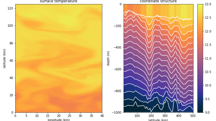
Ocean models are used in a large variety of applications, from research to industry: climate projections, shipping forecasts, or even enhancing our understanding of the physical processes. These models are numerical realisations of the physical equations, and by their nature there are limits on their precision. As a consequence, numerical limitations manifest in the solutions to the equations as undesirable or unphysical results. In particular, I'm looking at "spurious" mixing that can affect the ocean circulation in the models. I have created a new method for narrowing down the contributions to mixing in an ocean model. This motivated work to develop a new way of representing the vertical structure of the ocean within the model, which aims to reduce the spurious mixing and make better use of the available resolution. This method is dynamic, and I have therefore termed it the "adaptive vertical coordinate".


