Architecture of the Australian continental lithosphere
Some of the oldest continental building blocks (e.g. cratons) are found in Australia. At depth, the ancient rock record has invaluable information about the dynamics of the Earth. Seismology can provide remarkable views into the deep lithospheric structure using imaging techniques on broadband seismic data.
Project status
Content navigation
About
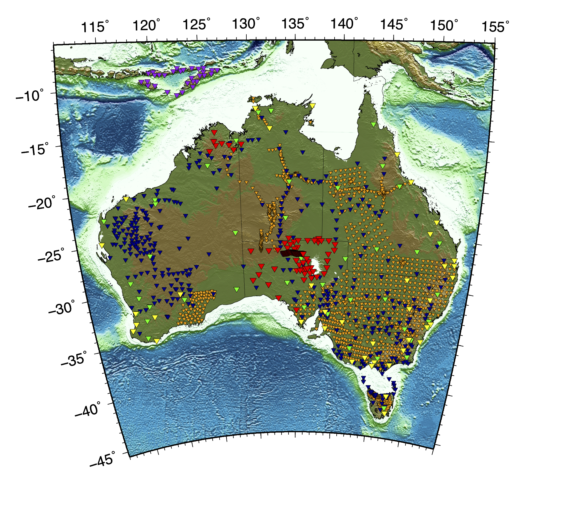
The continents are the location of the oldest and thickest lithosphere on Earth. Some of the oldest continental building blocks (i.e. cratons) are found in Australia. At depth, the ancient rock record has invaluable information about the dynamics that has shaped the Earth. Much of that history has been dominated by plate tectonics which has repeatedly assembled and broken apart the continents through the Wilson Cycle. While the younger regions of continental lithosphere have been subject to deformation driven by plate tectonics, it is less clear whether the ancient, stable cores formed and evolved from similar processes. We have several projects that focus on continental formation and evolution from a seismological perspective. Seismology can provide remarkable views into the deep lithospheric structure using imaging techniques on broadband seismic data. The Australian continent provides a long and complex record of the evolution of the lithosphere and much of the continent remains to be explored. We have two active deployments in central Australia and southwestern Australia (see more below) as well as a wealth of legacy data as shown in the map of seismic stations above.
Nature of Project(s): Computational and numerical
Available Projects:
ARC Linkage Project: Enhanded 3-D seismic structure of Southwest Australia (SWAN) - Lead Investigator Miller
A new deployment of 25 passive seismic instrumentation (SWAN=South-West Australia Network) provides data that will dramatically improve the rendering of 3-D structure in the crust and mantle lithosphere. Such information is essential for better characterisation of the location and depth of the regional earthquakes, and hence understanding of earthquake hazard. We seek students to work on a series of projects that include determining crustal thickness and velocity structure, creating a seismic catalogue from local earthquakes in the region, and simulate ground motion for scenario earthquakes.
ARC DECRA Project: What's Shaking Down Under? - Lead Investigator Eakin
Essential Background: PHYS 3070 (Physics of the Earth); EMSC 8023 (Advanced Data Sciences); EMSC 80XX (Computational Geosciences).
General Background: Seismology, the study of seismic waves, has a wide range of applications of societal importance, from seismic hazards, to discovery of natural resources, to Earth evolution. Through the recording and then analysis of seismic data, which can originate from earthquakes, ocean noise, or man-made sources, seismologists image the structure of the Earth from the surface to the core. Seismic imaging is the only approach that can reveal structure and processes that are both currently active (e.g. faults, earthquakes, volcanoes) and infer those that occurred billions of years ago (e.g. orogenesis and formation of the continents).
Members
Supervisor

Senior Lecturer
Fellow

Professor
ARC Future Fellow