Exploring seismic structure and local seismicity at the Lake George basin, NSW with a dense seismic array
The base of the Lake George fault scarp defines the edge of the basin and previous surveys suggested the Quaternary fault zone extends at depth. A dense seismic array of 100 nodal seismometers were deployed in late 2020 in the northern section of the basin and collected continuous seismic recordings for ~1 month
Project status
Content navigation
About

Standing over the Weereewa Lookout ~35 km north of Canberra, Lake George is seen as a largely flat and extremely shallow basin, with a very small catchment. The base of the Lake George fault scarp on the western side of the lake, clearly defines the edge of the basin and previous surveys suggested the Quaternary fault zone extends at depth. However, our current understanding of the internal structure of the basin and its connection to the fault zone remains limited. A dense seismic array of 100 nodal seismometers were deployed in late 2020 in the northern section of the basin and collected continuous seismic recordings for about one month. This data provides unique opportunity to improve the rendering of the 3-D structure of the basin as well as identifying any possible seismic activity. We seek students to work on a series of projects to 1) characterize the seismic structure of the basin and fault zones, using seismic imaging techniques such as ambient noise interferometry, coda wave correlation, polarization analysis and receiver functions; 2) explore the local seismic activity in the region for insights on the status of the fault zone; and 3) monitor environmental response of the near-surface structure.
This will be a collaboration project with EM. Prof. Bradley Pillans within RSES and Dr. Dan Clarke at Geoscience Australia who led a recent scientific drilling program at sites located within our seismic array, potentially providing geological ground truth to complement this seismic study.
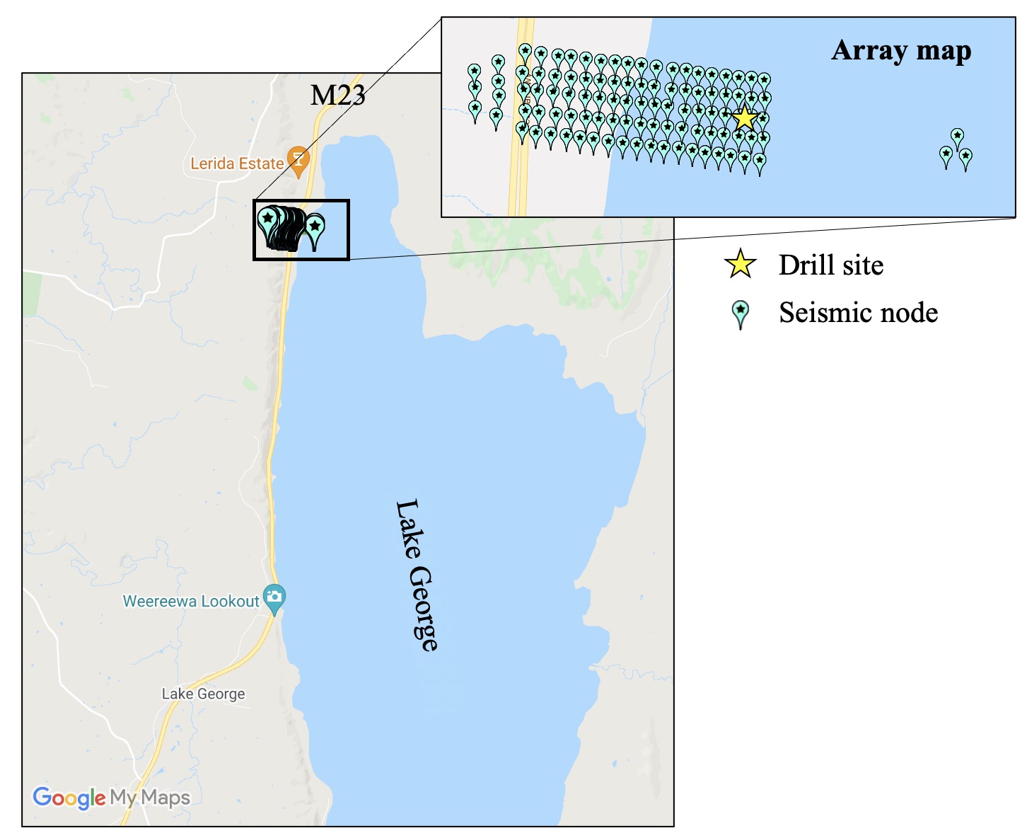
Map of the 100 node seismic deployment at Lake George in December 2020.
Members
Supervisor

ARC DECRA Research Fellow

Professor
ARC Future Fellow
Collaborator
Emeritus Professor