Imaging lithosphere structures of the Earth’s hidden continent, Zealandia
Zealandia, the Earth’s hidden continent submerged in the southwest Pacific Ocean, is the youngest and thinnest geological continent in the world. Yet, how this continent is formed remains to be further explored, mostly due to a poor understanding of its sub-surface structure.
Project status
Content navigation
About
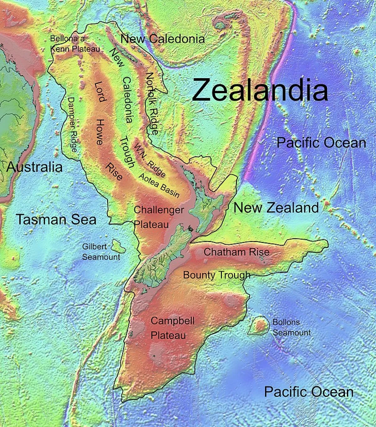
Zealandia, the Earth’s hidden continent submerged in the southwest Pacific Ocean, is the youngest and thinnest geological continent in the world. Yet, how this continent is formed remains to be further explored, mostly due to a poor understanding of its sub-surface structure. This project aims to construct a high-resolution image of the lithosphere structures beneath the hidden continent using seismic noise interferometry and advanced tomography techniques. The dense and permanent seismic networks across the eastern Australia, New Zealand and several islands in between, such as New Caledonia and Vanuatu, provide the valuable and existing data sets for this project. The expected output of this project, a detailed image of the lithosphere in the region, will not only help to investigate processes of continental rifting, thinning, and breakup in general, but also provide a chance to explore the interaction of mantle-plumes with the continent, a process of importance for the formation of mineral deposits.
More details on the methodology related to this research topic can be found in Mordret, 2018 (JGR) doi: 10.1029/2017JB015104 and Yang, 2014 (GJI), doi: 10.1093/gji/ggu234.
Nature of Project(s): Computational and numerical
Essential Background: PHYS 3070 (Physics of the Earth); EMSC 8023 (Advanced Data Sciences); EMSC 80XX (Computational Geosciences).
General Background: Seismology, the study of seismic waves, has a wide range of applications of societal importance, from seismic hazards, to discovery of natural resources, to Earth evolution. Through the recording and then analysis of seismic data, which can originate from earthquakes, ocean noise, or man-made sources, seismologists image the structure of the Earth from the surface to the core. Seismic imaging is the only approach that can reveal structure and processes that are both currently active (e.g. faults, earthquakes, volcanoes) and infer those that occurred billions of years ago (e.g. orogenesis and formation of the continents).
Members
Supervisor

ARC DECRA Research Fellow

Professor
ARC Future Fellow